
www.auto-innovations.net
26
'26
Written on Modified on
Integrated Automotive Navigation And Driver Assistance Architectures
Human Machine Interface Integration In Advanced Driver Assistance Systems By The BMW Group.
www.bmw.com
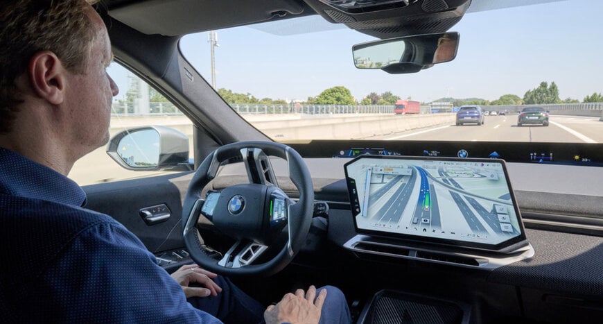
Modern vehicle architectures face significant cognitive challenges when managing complex motorway layouts, multi-level intersections, and dense urban traffic environments. Traditional cockpit configurations frequently isolate route guidance instructions from advanced driver assistance systems telemetry, presenting mapping data on one interface while environmental perception data remains separate on another display. This division forces vehicle operators to mentally reconcile route instructions with live sensor data during complex driving maneuvers. To resolve this operational gap, the BMW Group introduces BMW Maps with Driver Assistance, an integrated visualization framework designed for vehicles equipped with BMW Operating System X. Scheduled for release in October 2026, this system merges turn-by-turn route guidance with real-time sensor perception into a unified three-dimensional graphical interface on the central display.
System Architecture And Operating Principles
Developed in collaboration with Mapbox, the integrated platform fuses high-precision mapping data with live environmental sensor inputs. Rather than treating navigation and automated driving control as independent tasks, the system renders the vehicle immediate surroundings, including detected lane markings, adjacent traffic participants, and active assistance states, directly alongside the active route. The interface renders the host vehicle within its exact lane and on the correct level of multi-level roadway structures, which significantly reduces navigation ambiguity on complex motorway junctions. Operators gain clear visual feedback regarding how assistance algorithms interpret complex scenarios, helping build operational transparency during extended periods of automated driving. The software relies on map technology and data architecture from Mapbox combined with navigation data from BMW Maps to maintain high-performance rendering across digital cockpit displays.
Industrial Use Cases And Deployment
The convergence of navigation data and environmental perception addresses specific operational challenges across different road typologies. On controlled-access motorways, features such as the Highway Assistant support hands-free driving operations at speeds up to 130 kilometers per hour. When active route guidance is engaged via BMW Maps, the system coordinates longitudinal and lateral control from entry ramp to exit ramp, supporting automated lane changes following a mirror-check confirmation from the driver. Urban environments present significantly higher complexity due to dynamic traffic controls, variable priority rules, and dense intersections. To address these conditions, navigation-led, semi-automated urban driving functions are slated for rollout beginning in 2027 for compatible models running BMW Operating System X.
Stephan Durach, Senior Vice President of Digital Services, Infotainment and Connected Company at the BMW Group, explains the strategic relevance of this development: An important step toward highly automated driving is the intelligent interaction between navigation and driver assistance. BMW Maps with Driver Assistance shows drivers how route guidance, environmental perception, and assistance functions work together, providing better orientation when driver assistance is active.
Additional Context
This section details technical specifications and competitive benchmarking not included in the original product announcement
The integration of advanced visualization tools into digital cockpits reflects broader industry trends toward software-defined vehicle architectures and human-machine interface transparency. Similar visualization approaches have been adopted across various high-end automotive platforms, leveraging real-time sensor fusion combined with high-definition vector maps to render surrounding traffic dynamics. As regional regulators establish frameworks for automated lane-keeping systems and hands-free driving capabilities, clear driver notification systems and intuitive state-awareness interfaces have become essential requirements for functional safety and operator oversight. The reliance on cloud-connected rendering engines allows vehicles to maintain localized rendering performance even within cellular dead zones via predictive map data caching.
Edited by Maria Brueva, Induportals editor – adapted by AI.
www.bmwgroup.com
